Ashtabula County Maps
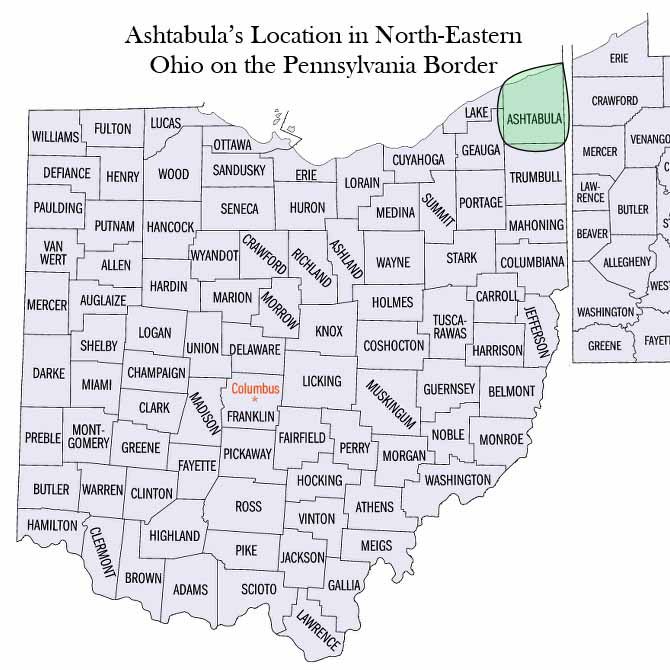
Ashtabula County occupies the northeast corner of the State of Ohio, and of the Western Reserve. Its territorial limits embrace both land and water. The land portion is bounded on the north by Lake Erie, on the south by the county of Trumbull, on the east by the northwestern part of Pennsylvania, and on the west by the northern part of Geauga county, by Lake county, and by the waters of Lake Erie.
Its capital town is Jefferson, which is situated in the eleventh township of the third range, and is in latitude 41° 45′ north, and in longitude 80° 45′ 5″ west. Its entire territory embraces a total area of nine hundred and seven square miles, two hundred and twenty of which are water. The land portion, in reference to which, as disunited from the water of the lake, it is more properly considered when regarding it as an organized county, contains an area of six hundred and eighty-seven square miles, and is larger, by about fifteen square miles, than any other county in the State. – History of Ashtabula County, Ohio by Williams, W. W. Pub. 1878
Note: Click on map image to zoom in.
Map |
Description |
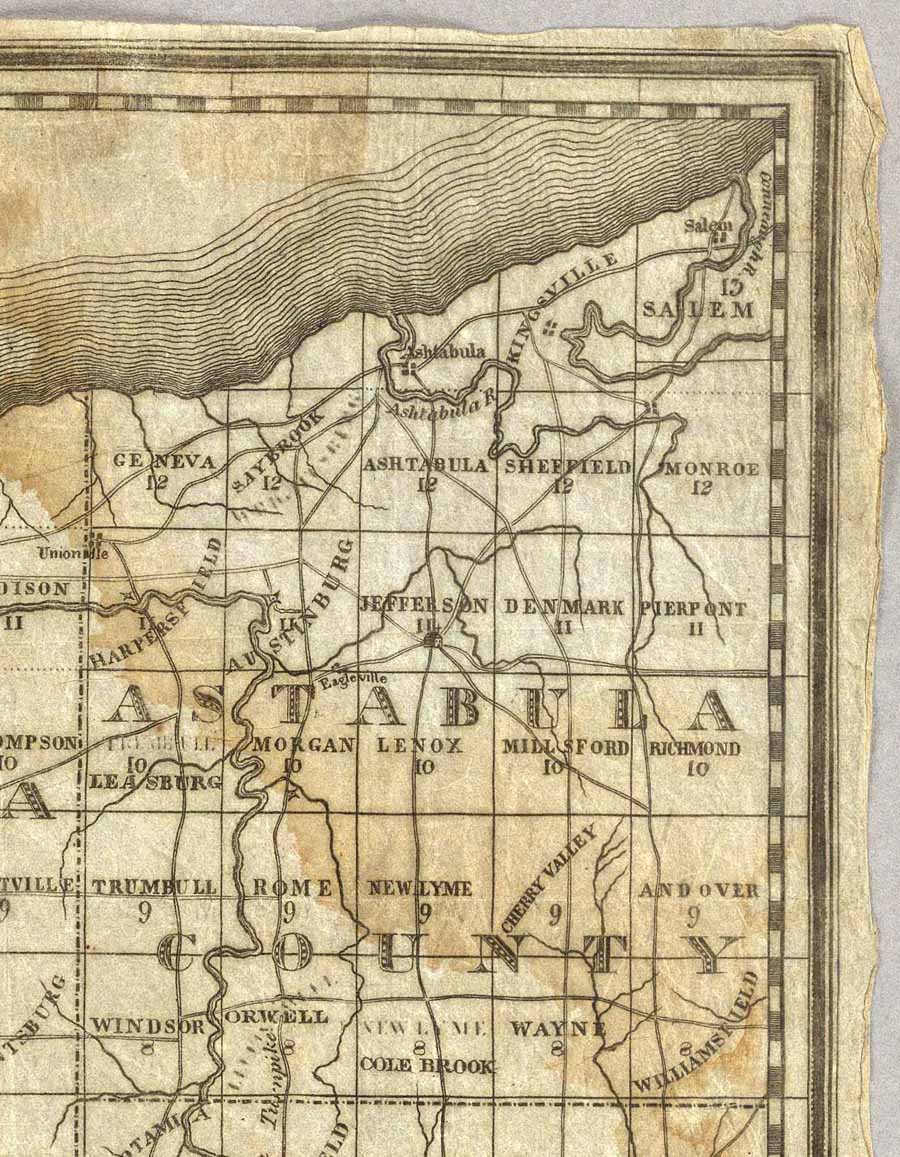 |
1833 Ashtabula County – taken from the “Map of The Western Reserve Including the Fire Lands In Ohio. Published By Allen Taylor, Nelson-Portage County, Ohio. Revised & Corrected March 1, 1833” |
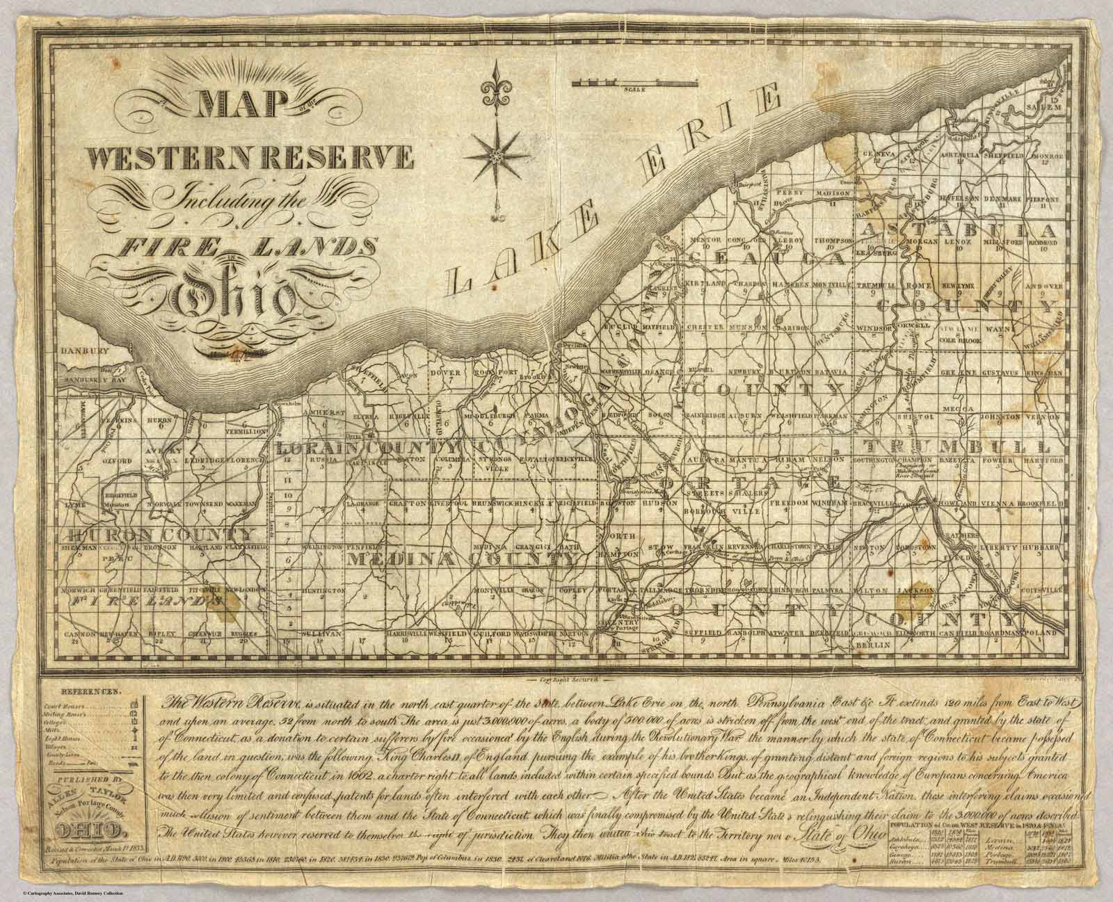 |
Map of The Western Reserve Including the Fire Lands In Ohio – Published By Allen Taylor, Nelson-Portage County, Ohio. Revised & Corrected March 1, 1833 |
 |
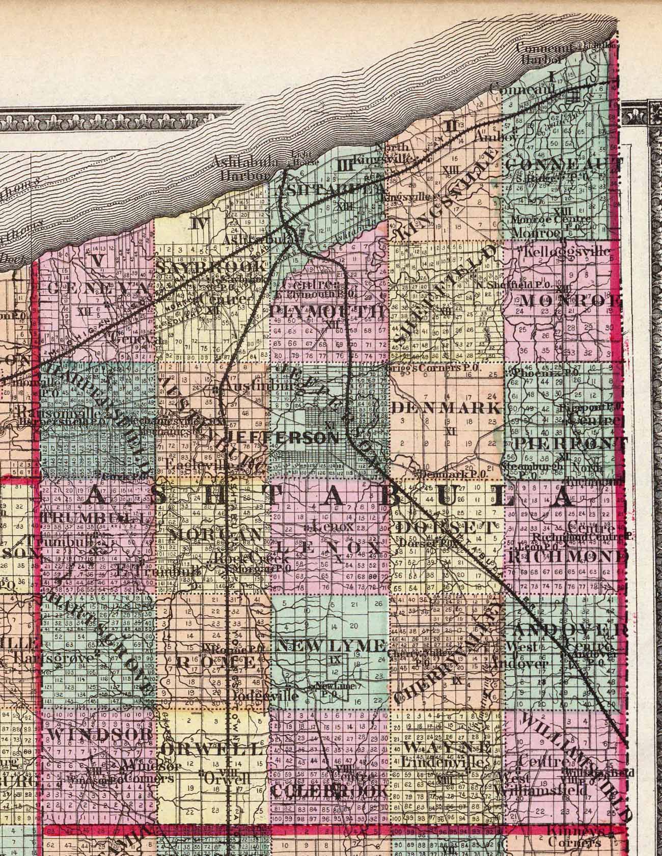
1868 Ashtabula County – close up from Western Reserve Pub H.H. Lloyd & Co. for Henry S. Stebbins – davidrumsey.com |
 |
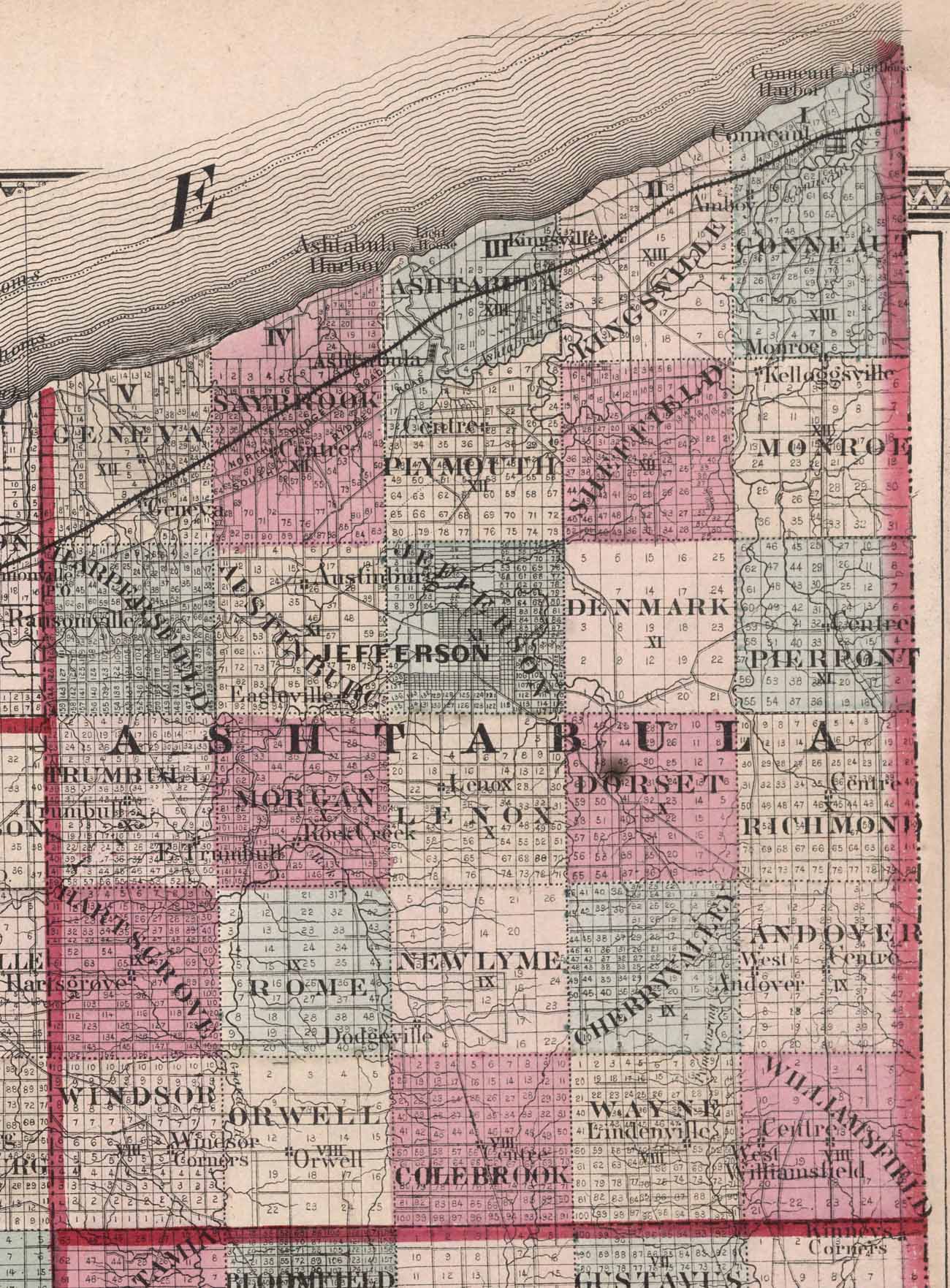
1872 Ashtabula County – showing Post Offices – Stedman, Brown & Lyon – davidrumsey.com |
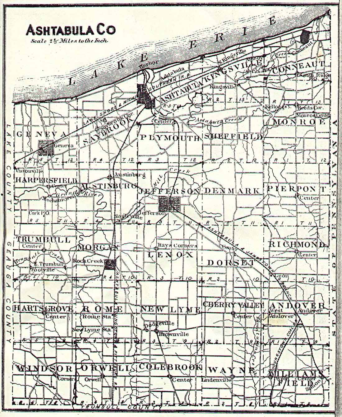 |
1878 Ashtabula Townships – Township map of Ashtabula County |
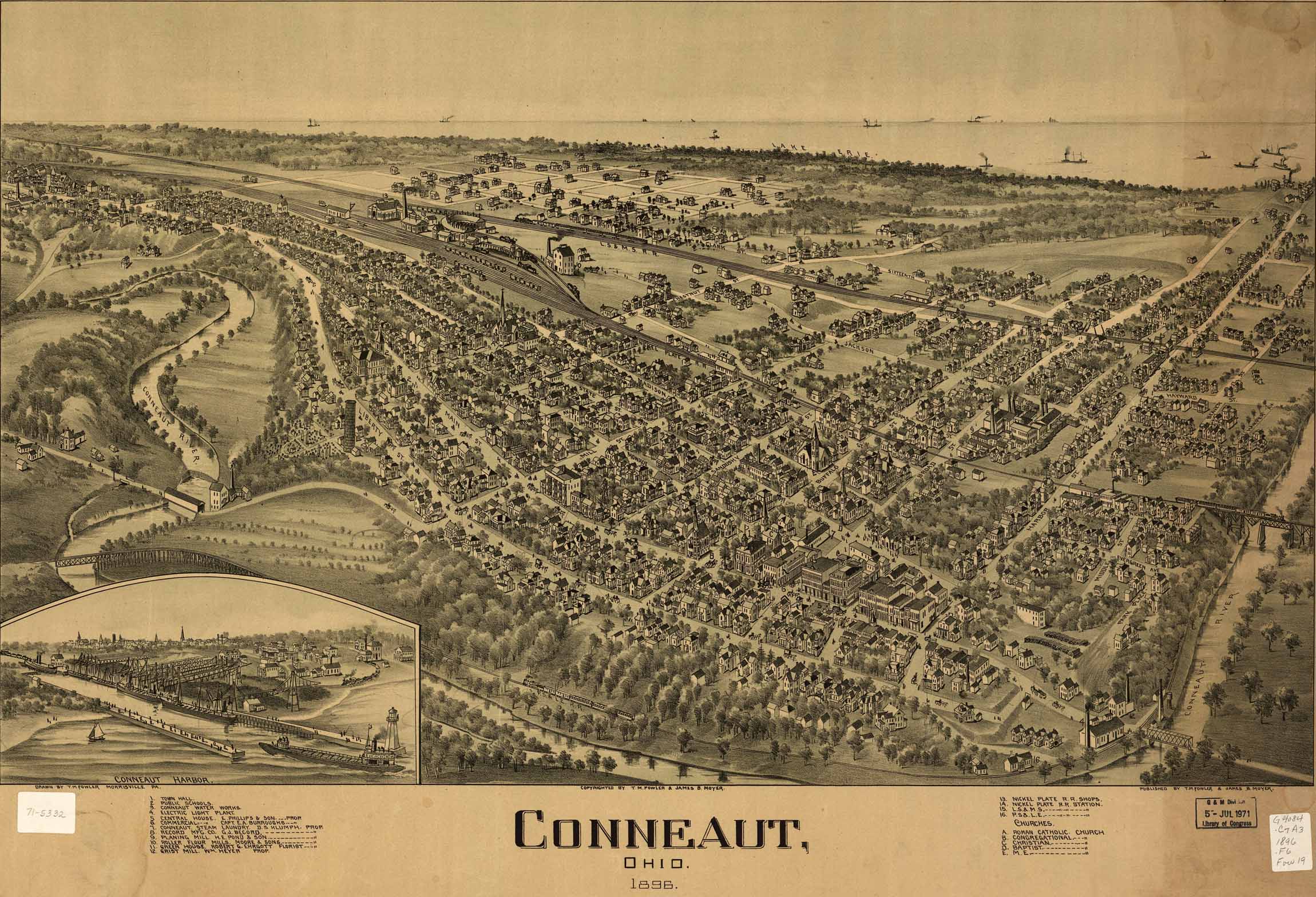 |
1896 Panorama map of the town of Conneaut – showing harbor and important buildings. by Fowler, T. M & Moyer, James B. – Library of Congress |
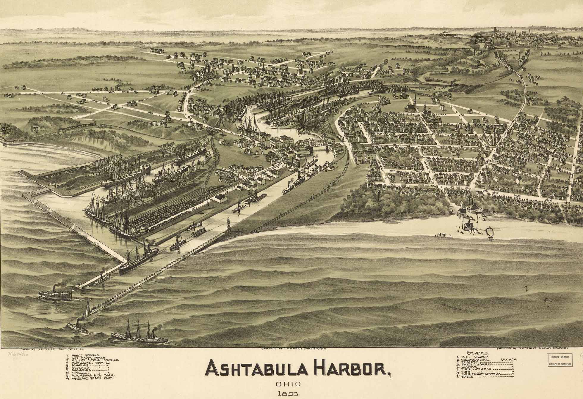 |
1896 Panorama map of Ashtabula Harbor – showing important buildings. by Fowler, T. M & Moyer, James B. – Library of Congress |
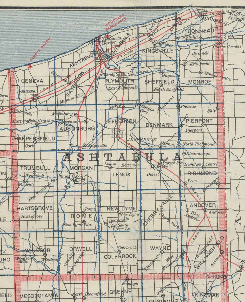 |
1895 Ashtabula County from Stranahan’s Map – Stranahan’s township map of Northern Ohio: showing road and bicycle routes, railroads and electric lines – Cleveland Memory Project |
Page Created August 2022
Be First to Comment